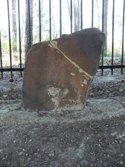
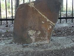
The stone was set by the joint U.S.-Spanish survey party on April 10, 1799. Made of sandstone, it is roughly two feet high and eight inches thick. On the north side of the stone is the inscription "U.S. Lat. 31, 1799." On the south side is "Dominio de S.M. Carlos IV, Lat. 31, 1799."
Treaty

YearAdded:
Image Credit: Public Domain (Author's Choice)Image Caption: Ellicott's StoneEra_date_from: 1799
1968
Innovations

The stone was set by the joint U.S.-Spanish survey party on April 10, 1799. Made of sandstone, it is roughly two feet high and eight inches thick. On the north side of the stone is the inscription "U.S. Lat. 31, 1799." On the south side is "Dominio de S.M. Carlos IV, Lat. 31, 1799."
…
Read More

