El Camino Real (literally, "the royal road") is the oldest and longest historical trail in the Western Hemisphere. The transportation link has, through the centuries, been called various names, including El Camino Real de Tierra Adentro (literally, "the road to the interior" because the U.S. frontier was seen as the country interior to Mexico), the King's Highway and the Royal Highway. It became a transportation lifeline that helped integrate Spanish and European culture in the Southwestern U.S.
1000-1599
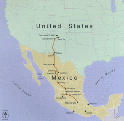
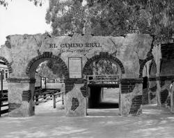
Historically, a camino real (Royal Road) is defined as a road that connects Spanish capital with Spanish capital, a distinction not shared with roads connecting ordinary Spanish or Indian villages. The term Camino Real implied that the status and privileges granted to the villas and capitals it connected were extended to the main routes of travel through use by officials and others acting in the interest of the crown. Unlike ordinary Indian and Spanish villages, villas like San Antonio and others along the route had charters that prescribed royal privileges.

TiponCountry: PeruWebsite: http://www.asce.org/Project/Tipon/Creator: Incan Civilization and predecessors
Tipon is a self-contained, walled settlement that served as an estate for Inca nobility. Located 13 miles down the Huatanay River Valley by the Inca capital of Cusco, the 500-acre archeological site provides knowledge and better understanding of the pre-historic Inca and their irrigation and building skills. The site represents great mastery of irrigation and hydraulic technology. The civil engineers of Tipon designed buildings, 13 integrated central terraces, waterworks, hundreds of other terraces and massive structures to be visually and functionally harmonious with their surroundings.
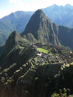
Machu Picchu represents the culmination of Inca public works building standards and technology, as well as 4,000 years of Andean community development. This landmark is the most well known archaeological site in South America and serves as a destination site for world travelers. It was a royal estate for Emperor Pachacuti.
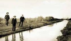
Developed by the Hohokam, a prehistoric group of Native Americans, the canal system in the Salt River Valley serviced more than 100,000 acres of mostly arid desert country in what is now southern Arizona. The prehistoric Hohokam constructed one of the largest and most sophisticated irrigation networks ever created using pre-industrial technology.
Innovations
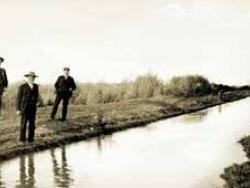
Developed by the Hohokam, a prehistoric group of Native Americans, the canal system in the Salt River Valley serviced more than 100,000 acres of mostly arid desert country in what is now southern Arizona. The prehistoric Hohokam constructed one of the largest and most sophisticated irrigation…
Read More
Machu Picchu represents the culmination of Inca public works building standards and technology, as well as 4,000 years of Andean community development. This landmark is the most well known archaeological site in South America and serves as a destination site for world travelers. It was a royal…
Read More
Tipon is a self-contained, walled settlement that served as an estate for Inca nobility. Located 13 miles down the Huatanay River Valley by the Inca capital of Cusco, the 500-acre archeological site provides knowledge and better understanding of the pre-historic Inca and their irrigation and…
Read More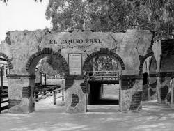
Historically, a camino real (Royal Road) is defined as a road that connects Spanish capital with Spanish capital, a distinction not shared with roads connecting ordinary Spanish or Indian villages. The term Camino Real implied that the status and privileges granted to the villas and capitals it…
Read More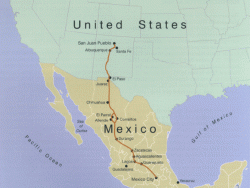
El Camino Real (literally, "the royal road") is the oldest and longest historical trail in the Western Hemisphere. The transportation link has, through the centuries, been called various names, including El Camino Real de Tierra Adentro (literally, "the road to the interior" because the U.…


